Mapping the way
for mission-driven organizations
Geospatial science
Over 15 years of experience creating, collecting, and managing spatial data with remote sensing and GIS software packages
Web mapping
Designing and developing web applications for visualizing, managing, and distributing spatial data and cartographic products
Training and documentation
Leading technical trainings and producing easy-to-use documentation for geospatial analysis and web apps
Geospatial science
- Cartographic product design
- Rule-based image classification for land cover analysis
- LIDAR data processing, especially for hydrologic models
- Python scripting for automating tedious tasks, typically with arcpy, Pandas, and R
- ArcGIS 10.x, ENVI, QGIS, Whitebox GAT, GDAL/OGR
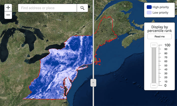
Prioritizing habitat for imperiled species
Working with a network of state and federal agencies, academic institutions, and non-profit organizations to empower environmental professionals with maps
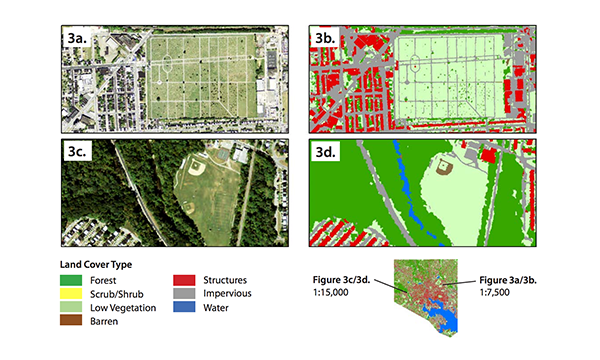
Green Infrastructure in Baltimore
Produced and documented three geospatial technology resources to help guide, expand, and strengthen the network of green infrastructure in the Greater Baltimore Wilderness region
Web mapping
- Responsive single page and multi-page web map applications
- Data visualization and asset managment
- HTML/CSS/JS, WordPress, React.j, NextJS
- ArcGIS JS API, Mapbox, Carto, Leaflet
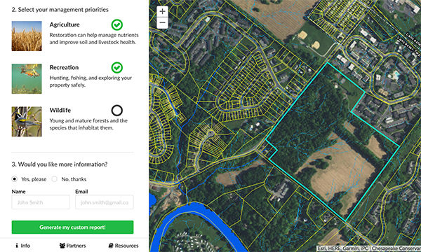
Restoration Reports
Providing environmental professionals a new tool to help land owners understand how water moves across their property and encourage adoption of best management practices
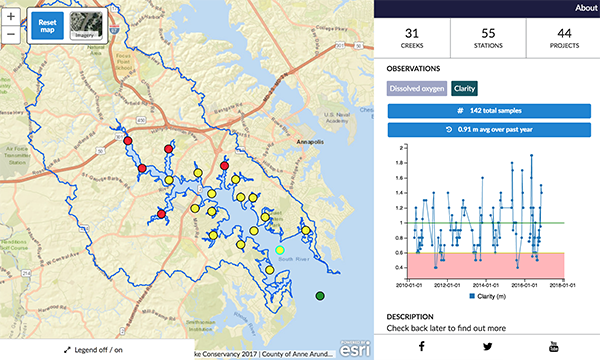
Visualizing water quality
Helping community members understand how healthy their watershed is by visualizing years of sampling data
Training and documentation
- Written technical documentation
- Classroom-based and virtual training
- Conference and workshop presentation
- Adobe creative suite, Loom, iorad
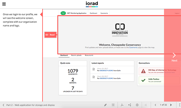
Online resources
Online tutorial for using a custom asset management application developed for the largest land trust in Maryland
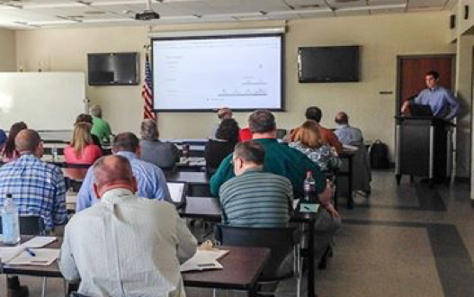
Classroom setting
Training given to the York County, PA Stormwater Consortium on a new web application developed to track stormwater projects